The main objective of the « Georeferencing » group is to build a parcel reference system for the city of Paris dated between the Vasserot plans (first « cadastre » surveyed between 1810 and 1836 by Philibert Vasserot and his team) and the current plan, by georeferencing the sheets of the cadastre established at the end of the 19th century.
It was initially decided to focus on the cadastral sheets established through surveys conducted between 1871 and 1896. Transferred to the Archives of Paris by the DTDF (Paris City Hall) in 2017, these sheets are now available for consultation online on the Archives’ website.

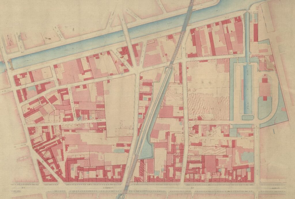
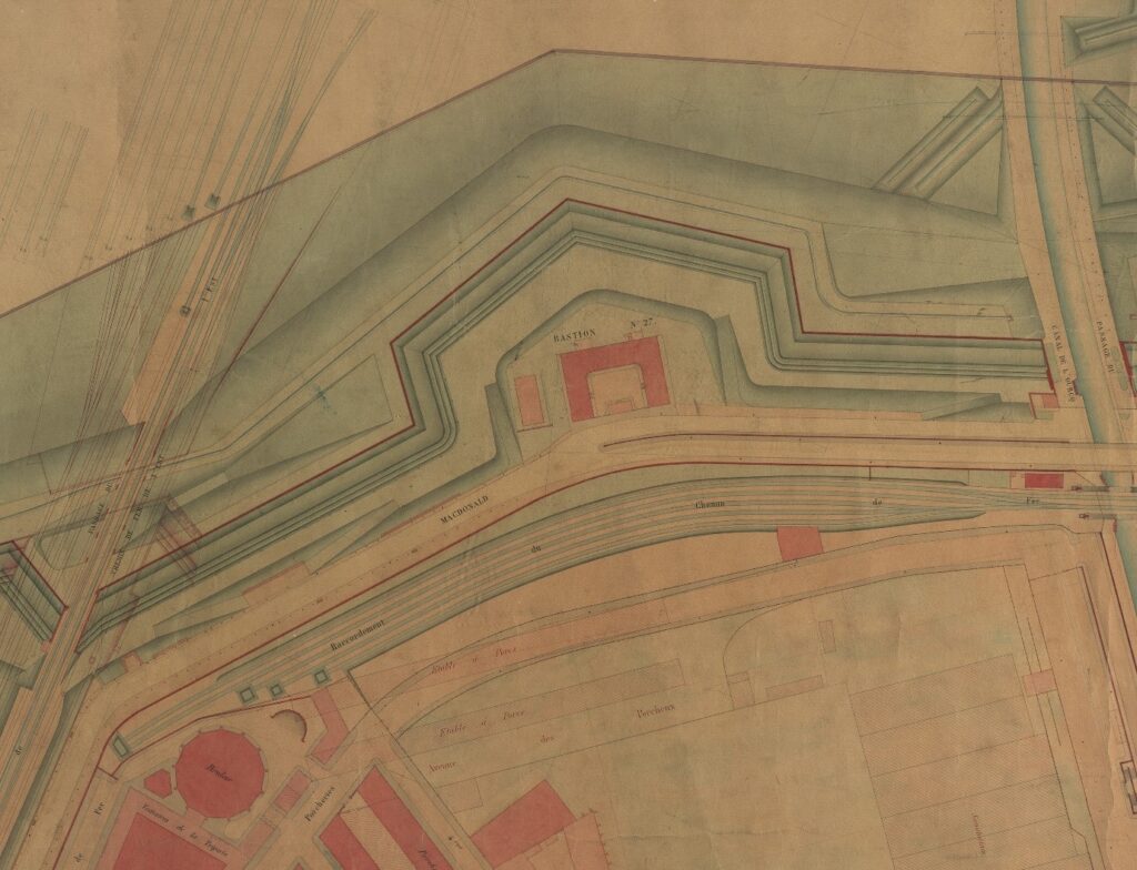
These colored plans drawn at 1:500 scale are very large and known as »bed sheets. Drawn with great care, they are teeming with details (the shape of shrubs, benches in parks, railway structures, etc.) whose presence testifies to the dual purpose of these plans: to represent the
urban plot but also more broadly the Parisian environment. Once georeferenced and accessible, these sheets will constitute a very rich map base as well as an essential documentation for researchers.

Thus, the representation of the details of the Thiers wall surrounding the city is already of great use to archaeologists who are and will still be frequently called upon to operate on plots of land once crossed by this fortification. In addition, the different states of the buildings presented on these sheets also make the richness of this documentation and will interest all researchers working on the evolution of the urban fabric.
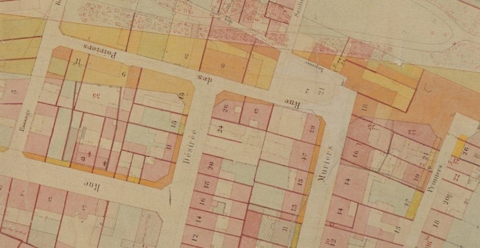
Indeed, between 1898 and 1901, all of the bed sheets were taken over by surveyors who transferred the new developments onto the sheets (for example, in yellow are the properties that had been destroyed and in red the new constructions) because the municipality decided to revise the cadastre in order to be able to establish new property taxes, intended to counterbalance the abolition of the tax on drinks in 1898. The 142 bed sheets were then divided into 732 sheets reproducing the land parcel at the same scale (1/500) and constituting the Atlas 1900, put on sale in 1903 (this atlas will also be georeferenced in the coming
months).

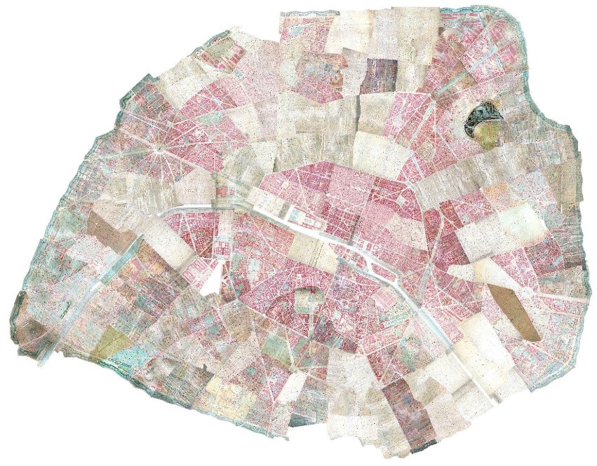
The georeferencing of the sheets of the Ist, IInd, IIIrd, IVth, Vth, VIth and VIIth districts was carried out by Emilie Cavanna (Pôle Archéologique – DHAAP) in early 2019. The rest of the series of « bed sheets » was georeferenced by Léa Hermenault who was hosted for this purpose for 4 months at the Pôle Archéologique de Paris (DHAAP). The georeferencing was completed at the end of August 2019. The following figure shows the assembly.

Team members
Julien Avinain (Pôle Archéologique – DHAAP)
Emilie Cavanna (Pôle Archéologique – DHAAP)
Léa Hermenault (ArScAn, Universiteit Antwerpen)
Jean-Luc Pinol (ENS Lyon)
Paul Rouet (APUR)
Bibliography
Nathalie Bonnard, Plans de Paris par quartiers ou par arrondissement (atlas municipaux) et photographies de repères coordonnés (1937-1987), Service du plan de Paris, Juillet 2012
Christine Bal et Wuter Solis, Plan parcellaire de la ville de Paris 1900-1994, Archives de Paris, juin 2000.
Jean-Philippe Dumas, « Représentation et description des propriétés à Paris au XIXe siècle. Cadastre et plan parcellaire », in Mélanges de l’Ecole Française de Rome. Italie et Méditerranée, tome 111, n°2, 1999, p. 779-793
Préfecture du département de la Seine, Commission des contributions directes, Le livre foncier de Paris (deuxième partie), notice sur le cadastre municipal, Paris, 1902
