The recent acquisition of a 3D scanner (Leica BLK 360) has made it possible to open this new project. This equipment, acquired in co-ownership as part of the financing of a call for DIM projects in the Ile-de-France region, has been used by the CHCSC and DYPAC laboratories of the University of Versailles Saint-Quentin, the Geomatics Platform of the EHESS and the Arscan programme « ArcheoFab ».
The objective of this project, called Huma-3D, is to safeguard, enhance and process 3D heritage data. This equipment will also enable the joint and federative development of inter-laboratory projects associated with the work of the PTM Consortium on cultural or natural heritage spaces or places requiring 3D modelling. These projects will be developed within the framework of the DIM-MAP laboratory network, in close interaction with the training through research schemes run by the laboratories for advanced students at Master’s and Doctorate level.
This working group has therefore emerged on these bases and aims to link 2D reference systems with 3D data, thus opening up new possibilities: the creation of 3D geohistorical data and reference systems.
Several significant results can already be cited:
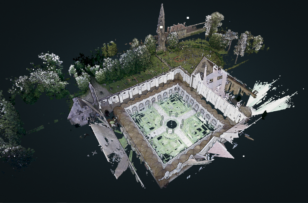
Abbey of Royaumont
During the consortium’s thematic school held at Royaumont Abbey in the summer of 2021, and in the framework of a workshop involving invited members (University of Limoges, member of the MAP laboratory in Marseille and the Huma-Num 3DSHS Consortium), 3D laser scanning was used to acquire photogrammetric and lasergrammetric data on the abbey site.
These results are available at: paris-timemachine.huma-num.fr/royaumont/3d/

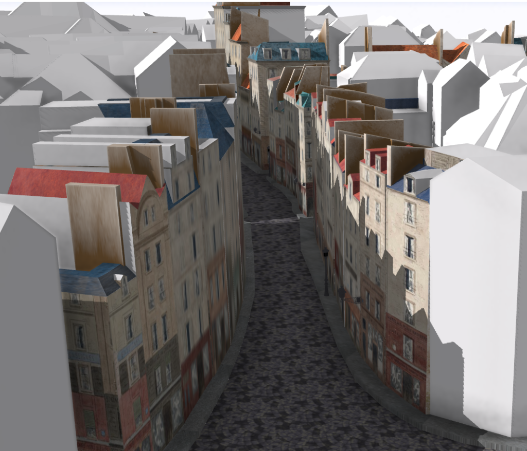
Rue Galande / Paris

The promising results of this work can be seen at: paris-timemachine.huma-num.fr/rue-galande-3d
This new project therefore remains to be continued and explored: recruitments and vacancies are underway to continue the work.
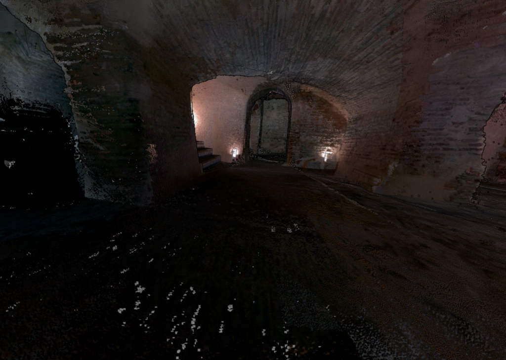
Underground synagogues and hydraulic machine of Toledo
The ANR VISMIN project, partner of the Huma-Num Paris Time Machine consortium, (http://vismin.huma-num.fr/) is interested in the study of the visibilities of the Jewish minority in medieval Spain of the Crown of Aragon). A research fieldwork took place in early September 2021 to acquire several underground synagogues and objects related to the Jewish quarter of the city of Toledo.
The results are available on the CST PTM potree server:


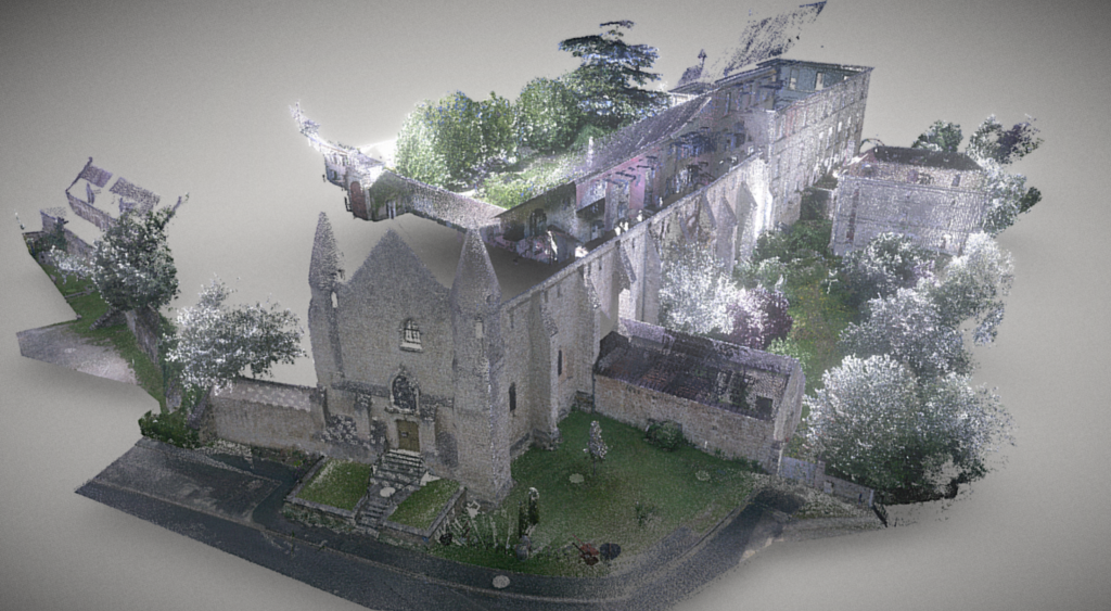
Abbey of Bourgeuil
The Abbey of Bourgueil, more precisely the Abbey of Saint-Pierre de Bourgueil-en-Vallée, is a Benedictine abbey. Founded in 990 by Emma, daughter of Thibaut the Ist, Count of Blois and wife of Guillaume, Duke of Aquitaine, it remained an important abbey throughout its history,a major abbey in the monastic landscape of the Middle Ages until the modern period. It also underwent many changes during its history until it was sold as national property in 1789. The abbey regained its religious vocation in the 19th century when the nuns of the Congregation of the Sisters of Saint Martin, a group of Carmelite nuns, moved into the monastic buildings to carry out their function of educating and assisting the sick and elderly. A little later, in the 20th century, the former abbey castle and the first floor of the large cellars were converted by the Sisters of St Martin into a training centre for future teachers and a retirement home for elderly nuns. After these activities ceased, the nuns left Bourgueil Abbey in 2016. The abbey then became a centre for the arts.
The WebGIS built by the UMR 7041 Archéologies et Sciences de l’Antiquité and carried out as part of the work of the Huma-num Paris-Time-Machine research consortium and the « Fabrique Numérique du Passé » programme (Digital Factory of the Past Project) aims to offer researchers and those involved in the abbey a tool for accessing the available documentation and a shared study medium integrating different representations of this remarkable historical architectural complex. The results of the study and survey campaigns, as well as the successive data integration operations The results of the study and survey campaigns, as well as the successive data integration operations, will complete the collection available and accessible to all in open data.

The abbey is thus becoming a space for methodological experimentation for multimodal scientific approaches, carried out by various teams who wish to to make their knowledge and work available to all in accordance with open science and the principles of open data (FAIR data). Thus, in addition to the various historical issues that can be developed on the site and its history, the objective is to constitute a corpus of data accessible to all the actors of the site to develop their thematic work whether they are scientists, visual artists, musicians or territorial actors.
Our approach is resolutely methodological and the interventions are targeted around the collection of data and the multimodal restitution of a site such as Bourgueil around two scales: that of the architectural ensemble with the restitution of of the architectural ensemble with the restitution of the existing (3D scan and photogrammetry) with work on the evolution of the architectural ensemble over time (archaeology of the building and analysis of cartographic interpretation); that of the territory and the insertion of the abbey in its landscape context with a broader archaeogeographic approach (web GIS).


Team Members
Laurent Costa (Research engineer, CNRS, ArScAn – UMR 7041)
Davide Gherdevich (Research engineer, laboratoire DYPAC, UVSQ)
Eric Mermet (Research engineer, CNRS/EHESS – CAMS/ISC-PIF)
Jean Passini (Research director / CNRS – EHESS – CRH)
Angelo Odore (Research engineer EHESS / Plateforme géomatique)
Trainees:
Clément Bauer (Ynov Campus Toulouse / Bachelor Animation 3D et jeux vidéo)
Colin Prudhomme (Ecole Centrale Lille)
