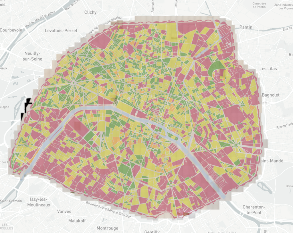
One of the consortium’s major problems is the creation of geohistorical data. The vector capture of the 1900 plans is linked to the georeferencing of the Parisian funds and continues this work by creating vector geohistorical reference frames (blocks, streets, addresses for 1900). The strategy implemented for the creation of these data is a regressive method: a reference frame is obtained by « degradation » of current data from available databases (OpenData Paris, IGN in particular).
Following on from the work on the georeferencing of 1900 parcel plans and the OCRisation of landowners’ directories, this working group has emerged to address the issue of modelling old vector data. This workgroup is interested in the reflection on good practices, in the drafting of specifications for the creation of old data and finally in their availability. The database and the progress of the collaborative input work can be seen at: http://ptm.huma-num.fr/plan1900/
Currently, the block and street 1900 repositories are being quality checked. Future work will focus on the creation of the address point repository.

In addition, a reflection is underway on a filiation model of Parisian streets, which could be generalised to other areas, using several sources: nomenclatures of Paris streets, old directories, web sources such as wikipedia, etc. Several developments are underway in this direction and will lead to the creation of a searchable API aggregating these sources and geohistorical filiations.
Team Members
Eric Mermet (Research Engineer, CNRS/EHESS – CAMS/ISC-PIF)
Paul Rouet (APUR)
Julien Avinain (Pôle Archéologique – DHAAP)
Paul Peignot (DHAAP – Ville de Paris)
Hugo Cador (DHAAP – Ville de Paris)
Valentine Rinner (Provider PTM / Plateforme géomatique EHESS)
Anne Varet-Vitu (Provider PTM / Plateforme géomatique EHESS)
Trainees:
Clément Bauer (Ynov Campus Toulouse / Bachelor Animation 3D et jeux vidéo)
Colin Prudhomme (Ecole Centrale Lille)
